If you want to get to know the surroundings of Kassel, Germany then you don’t need to search any longer: a hiking association (the Hessisch-Waldeckischer Gebirgsverein Kassel e.V.) has done a brilliant job and created a 160 kilometres long hiking path around the city. The so-called Kassel-Steig is broken into 12 sections you can each easily do within a day. And the best: these sections all start and end at places that are connected by train, tramway, RegioTram or bus to the city centre. A wonderful way to get to know the region – but with an altitude difference of 3000 meters also a challenging opportunity.
Loading map...

Here an overview of the 12 sections that are later described in more detail. As you can see the sections differ quite a lot in length, elevation and difficulty.
| # | Route | Length | Difficulty |
| 1 | Herkules – Weimar | 15 km | ambitious |
| 2 | Weimar – Mönchehof | 13.6 km | easy |
| 3 | Mönchehof – Rothwesten | 12.8 km | easy |
| 4 | Rothwesten – Landwehrhagen | 12.1 km | ambitious |
| 5 | Landwehrhagen – Heiligenrode | 11.5 km | easy |
| 6 | Heiligenrode – Oberkaufungen | 20.6 km | ambitious |
| 7 | Oberkaufungen – Wellerode | 11.3 km | easy |
| 8 | Wellerode – Dörnhagen | 14.3 km | easy |
| 9 | Dörnhagen – Großenritte | 16 km | easy |
| 10 | Großenritte – Hoof | 12.5 km | medium |
| 11 | Hoof – Brasselsberg | 12 km | ambitious |
| 12 | Brasselsberg – Herkules | 8 km | medium |
1: Herkules to Weimar
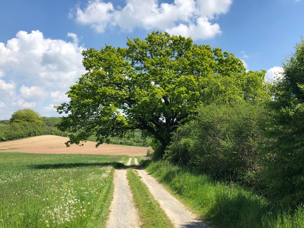
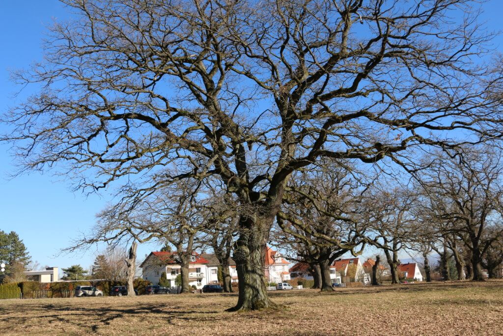
The Kassel-Steig begins – how could this be any different – at the Herkules monument. Get here by taking tramway 4 to Druseltal and switching there to bus 22. It brings you to the new visitors’ centre behind the monument. After having a look at the Bergpark and the city you need to return to the parking area in the back. From there the path leads you to the restaurant Silbersee and the Silbersee itself, a former quarry that is now filled with water.
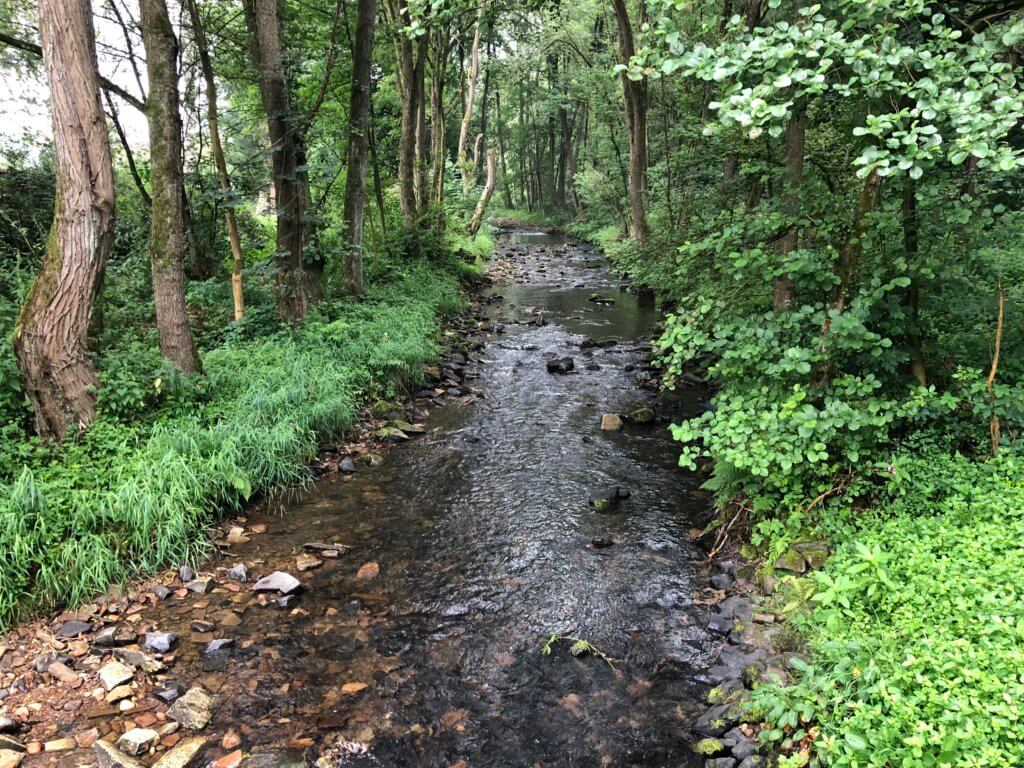
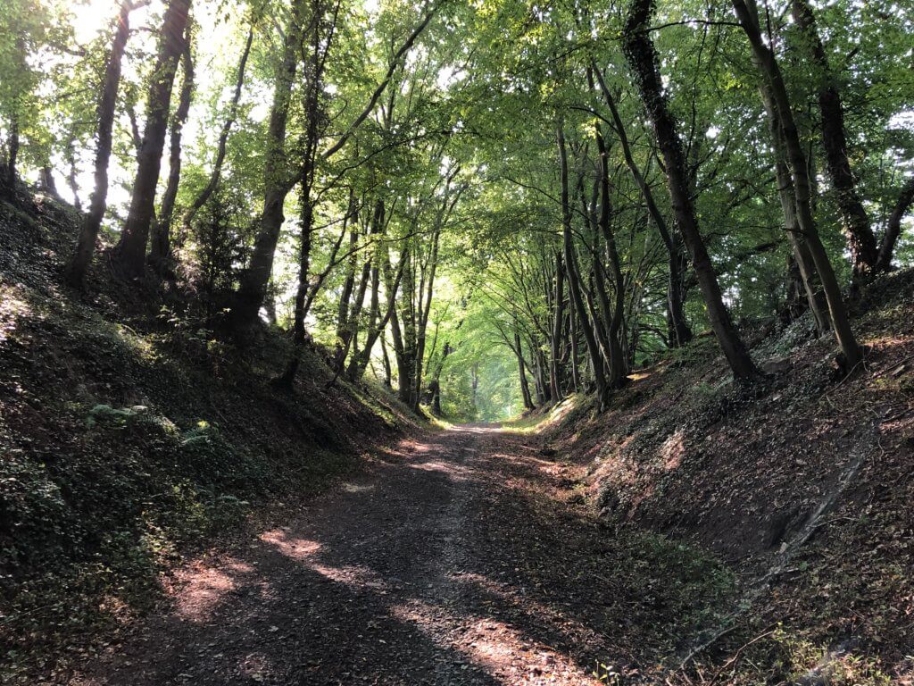
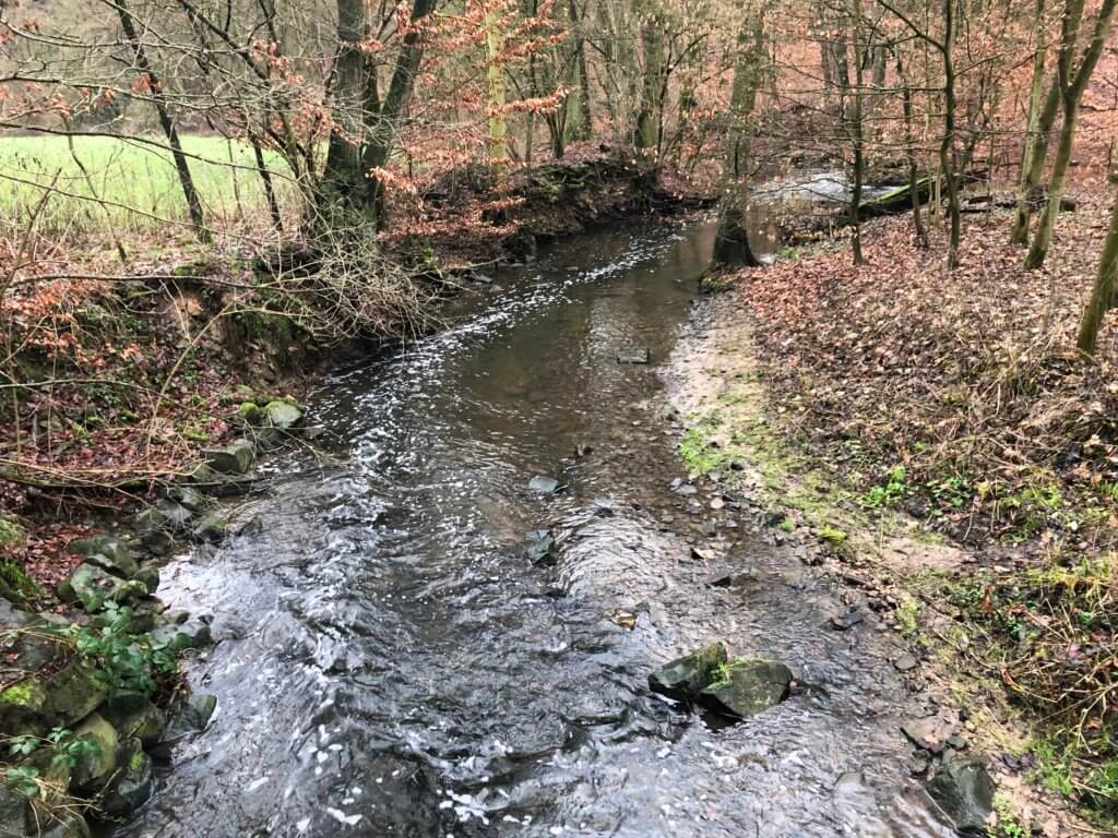
After that, you can either take a wonderful walk through the Ahnetal (where the small river has cut deep into the mountain) or stay on the Kassel-Steig that guides you up to the Hoher Dörnberg, the highest point in this section. It is quite a hard walk up but the views from there are really rewarding. From there you can also see the Helfensteine – bizarre rock formations that were created by erosion. You can also have good views on the glider airfield with gliders starting and circulating around.
The Dörnberg is the third oldest glider airfield in Germany and the area that you shouldn’t enter to not disturb the pilots is clearly marked. When you follow the Kassel-Steig further on it will guide you to the visitors’ centre of the nature protection zone Dörnberg and then down the hill towards Ahnatal-Weimar. There you can have a break at the lake Bühl before you reach the train station. RegioTram 4 (RT4 to Kassel Hbf) and regional train 4 (RB4 to Kassel-Wilhelmshöhe) can take you from there back to the city.
2: Weimar to Mönchehof
This section starts at the railway station of Ahnatal-Weimar which can be easily reached by trains from Kassel-Wilhelmshöhe. After passing under the railway tracks the path leads you up to a place below the mountain Hangarstein where you have good views on Weimar (which is by the way not to be confused with Weimar at Thuringia). Behind Weimar in the direction of Fürstenwald, you’ll underpass railway tracks and cross a street. You’ll see a nature reserve and walk on the old road from Leipzig to Amsterdam which was used to transport mail and goods.
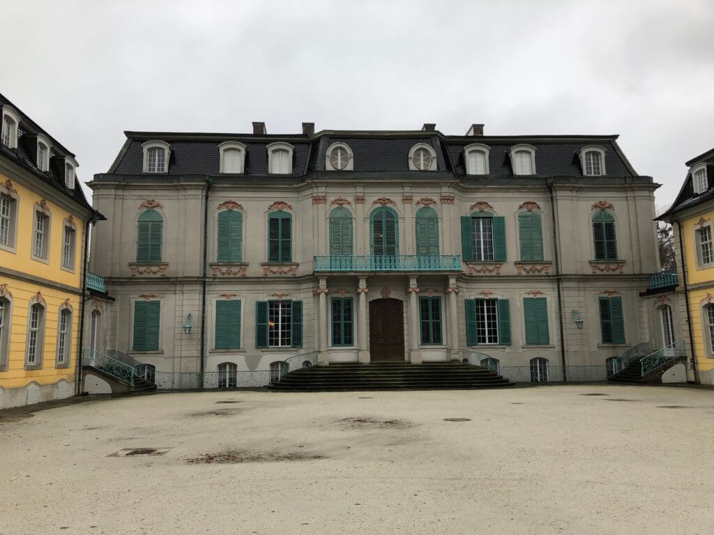
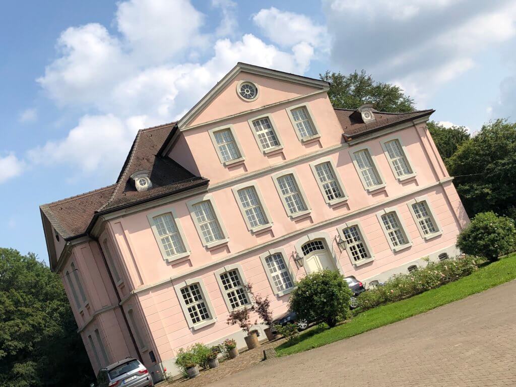
If you want a real highlight in this section you can pass between two forests to Wilhelmsthal, belonging to Calden, Germany. There you can find the rococo-style castle Wilhelmsthal within the Schloßpark Wilhelmsthal. It is a fantastic place and you’ll have to walk only 2.4 kilometres to get there. Otherwise, you can continue and walk in the direction of Heckershausen. The Kassel-Steig will guide you along and sometimes through the forest until you reach federal road B7. I found this to be the most beautiful part of the way, it also includes narrow sections and tiny paths on the forest ground.
When you have reached the B7 you, unfortunately, need to walk along it north for a while until there is the chance to cross it and reach an area of Espenau called Schäferberg. There you can get something to eat or drink at the good Waldhotel Schäferberg. The area has a dark history: during World War II forced labour workers were kept there – one of the barracks is still standing and has been converted to a church. Following the Kassel-Steig you’ll pass a forest cemetery, can have a look at the small lake Glockenteich (where birds can be observed) and then you’ll reach the railway station of Espenau-Möncheberg. RegioTram 1 takes you back to the city (but it is only going once an hour on weekends).
3: Mönchehof to Rothwesten
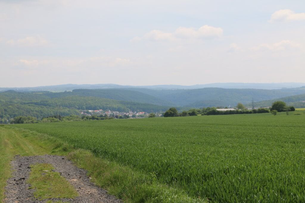
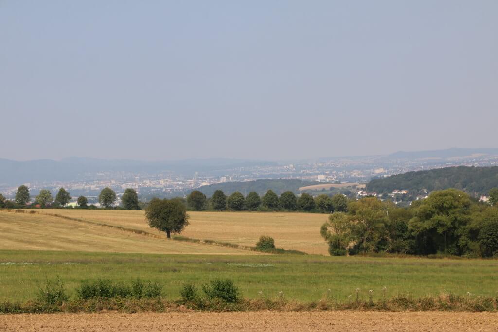
When arriving at Espenau-Möncheberg (with RegioTram 1) you’ll first have to use the underground passage to the other side of the tracks and follow the Bahnhofstraße to the small church and the statue of a monk (referring to the name of this place; ‘Mönche‘ means monks). The Kassel-Steig guides you through the city in the direction of Obervellmar. You’ll have good views on your way and there is often a place to sit down and relax. Then the path turns left, leads back over the railway tracks and brings you to the Vellmarer Höhe – a small hill with views on the whole Kassel area. Between green fields, it is a nice walk with many people passing by.
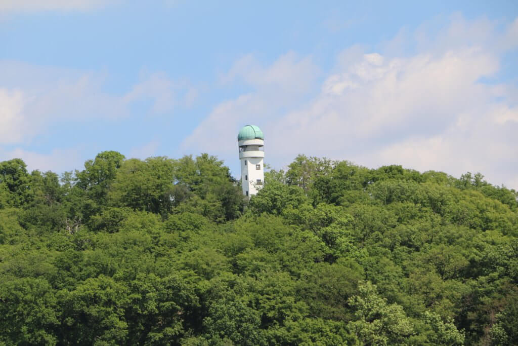
When reaching Vellmar again you can see the final stop of tramway 1 which now connects this place with the UNESCO world heritage site Wilhelmshöhe – something that the people here are really proud of. Relax under a giant willow next to a playground and then climb up to the hill Breiter Stein. Now you can enjoy great views on Fuldatal – including the observatory on hill Häuschensberg. When turning left and walking down the hill you’ll reach Jüttes Weidberghof – a farm selling their products and offering cake on weekend afternoons.
The last part of this section of the Kassel-Steig directs you towards the Volkssternwarte at Rothwesten – it can be seen from far away. But before you can reach it you need to enter Rothwesten itself. The path then leads you afterwards up to the Häuschensberg where you will find the observatory and an open-air stage. Then the Kassel-Steig doesn’t take the direct route (does it ever?) – it guides you to the former military airport (‘Fliegerhorst Rothwesten‘) and then down the village to the bus stop ‘Raiffeisenbank‘. Bus 40 takes you to ‘Kassel Ihringshäuser Straße‘ where you can take tramway 3 or 6 back to the city. But beware: on weekends the bus sometimes only goes every second hour.
4: Rothwesten to Landwehrhagen
This section of the Kassel-Steig is a tough one, prepare well. You can go by tramway 3 or 6 to ‘Kassel Ihringshäuser Straße‘ and switch there to bus 40. This bus line exists with two different destinations – take only the one to ‘Rothwesten / Sonnenallee‘. From the bus stop ‘Raiffeisenbank‘ of Rothwesten, Fuldatal the Kassel-Steig leads you up the hill. On the way, you can visit some ponds with water lilies if you like. Behind the Catholic church ‘St. Josef’ you’ll have to walk a bit on the road and cross a residential zone. Behind that, there is a former street next to the Gut Eichenberg which is now closed and a sign tells you to not walk on the street (but the Kassel-Steig requires you to walk there).
Then you’ll have to leave this abandoned road in the direction of a beautiful alley. At the beginning, you can see a small nice family graveyard on the left. After closing your nose and passing a composting plant the path leads you to the village Wahnhausen. Before reaching it you can see the target destination for this section on the other side of the river Fulda: Landwehrhagen, Staufenberg. But it will take hours to reach it, even if it looks so near. At Wahnhausen walk to the right and follow the forest road to a viewpoint on river Fulda and Gut Kragenhof. Walk down the steep tiny path and you’re standing in front of the watergate of Wahnhausen which you need to use to reach the other side of the river.
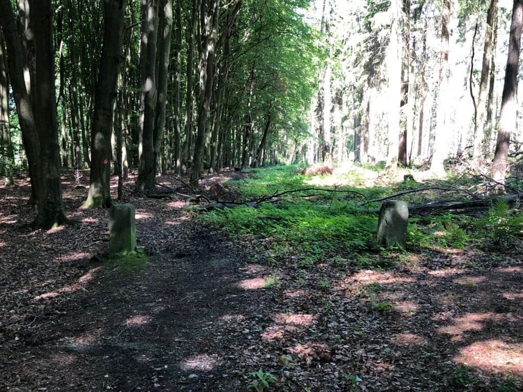
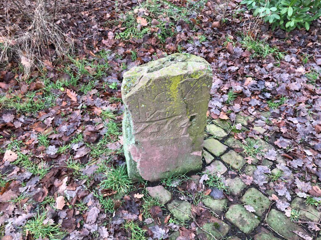
Now it is not walking down the hill anymore, but walking up. You’re now passing the unmarked border of the federal states of Hesse and Lower Saxony before you reach a bridge over a railway – the Hannöversche Südbahn. Walk on the street to Landwehrhagen, Staufenberg for some meters and then turn left into the forest. The path takes you up and down until you reach the Mühlenkopftunnel built for high-speed trains going from north to south and vice versa. From there it is a tough and steady walk up the hill. If you follow the signs precisely (and sometimes they are also missing in this section) you will find your way to a way that marks the border between Speele and Landwehrhagen, both belonging to Staufenberg. Old stones mark this border and then you will find a nice place to rest – the Reetz-Gehege.
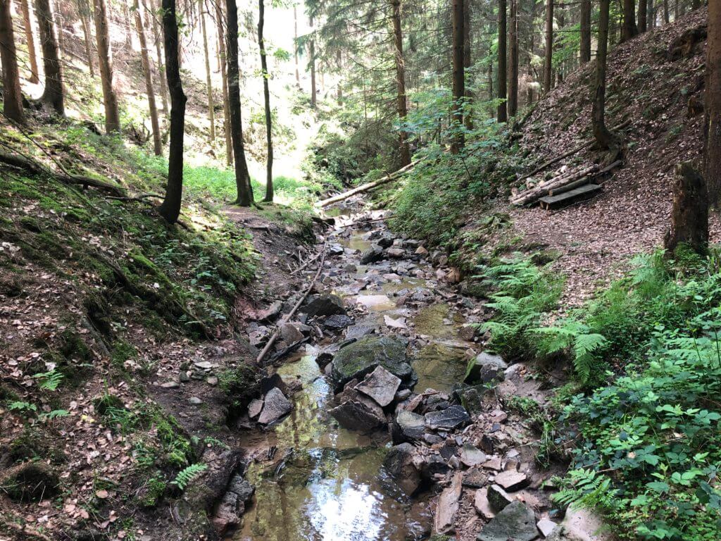
Some meters up the hill beauty is waiting: the Ickelsbach river who has cut down deep into the mountain. Use the wooden bridge and climb up towards the end of the forest and you will reach Landwehrhagen. Follow the Kragenhofer Straße to the Hannoversche Straße and there the final stop for this section can be found, the bus stop ‘Landwehrhagen Rathaus‘ (town hall)’. Bus 32 takes you back to Kassel – with stops for example at Platz der Deutschen Einheit, Am Stern or Hauptbahnhof. Keep in mind that on Sundays the bus here leaves only every second hour. Because of the high inclination of the section, it is hard to guess how much time you need, maybe better do this section on a Saturday. On the other hand: close to the bus stop you can find different restaurants to use your time well.
5: Landwehrhagen to Heiligenrode
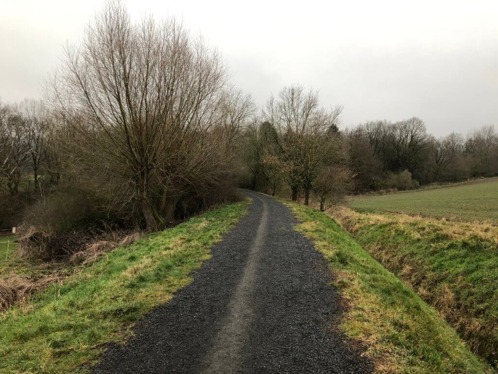
A relaxing section in contrast to the previous – but also not as beautiful, you’re walking most time kind of in parallel to motorway A7. Take bus 32 from Platz der Deutschen Einheit, Am Stern or Hauptbahnhof to ‘Landwehrhagen Rathaus‘ (final stop). Follow Gartenstraße and Siegenbornstraße to the fields. The Kassel-Steig leads you on natural paths and tarmac around Landwehrhagen and over motorway A7. On a zig-zag route, it brings you up the hill to a forest. Walk along the forest and when you see a small path into it – walk 100 meters inside to see the Niemandsland (no man’s land). Here the kingdom of Hannover and the landgraviate of Hesse-Kassel just left some space unassigned to allow both parties to use the way in the middle.
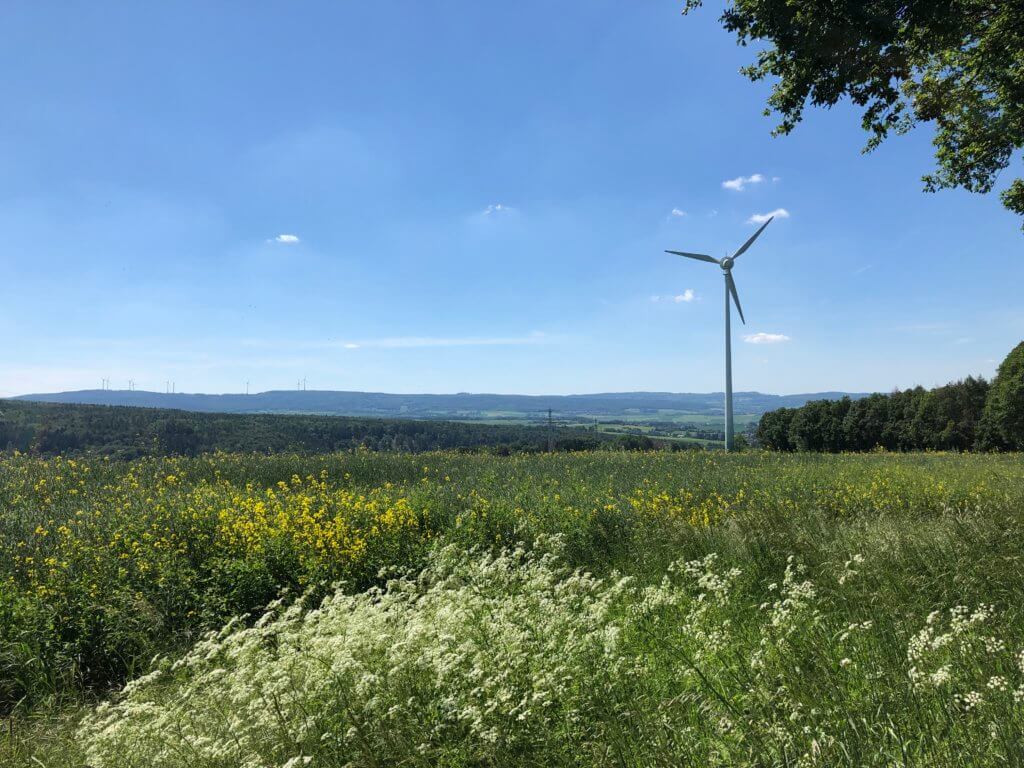
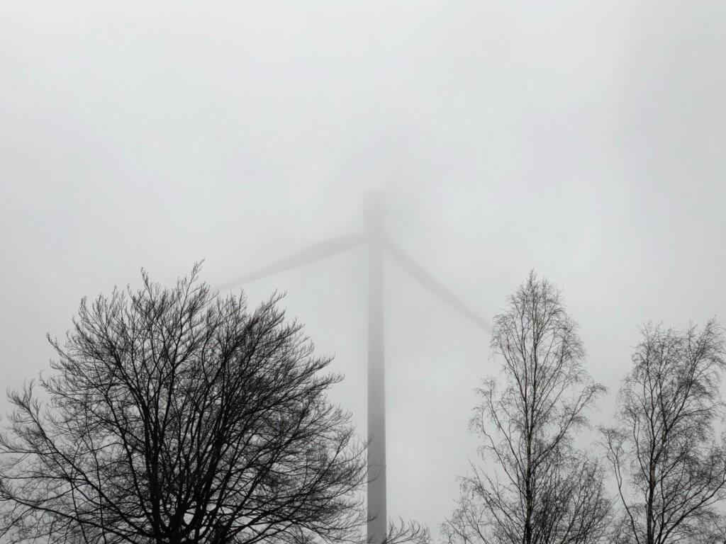
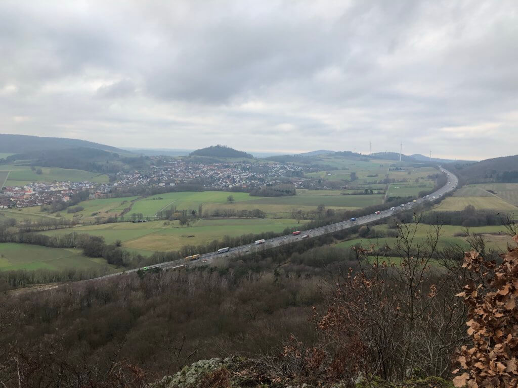
While walking along the forest you can enjoy good views on the surrounding villages and the Söhre mountain. Shortly before the end of the forest, there is a nice bench to sit down. Behind it the Kassel-Steig wants you to turn right and pass close to a giant windmill. Behind that, you can look at Kassel and the Kasseler Becken. Turn left and then left again and you’ll see a sign about the Sandershäuser Berg. In 1758 the French fought here against an army of soldiers from Hesse and Hannover. Behind that, you will pass Gut Ellerbach and one of the solar factories of SMA. Walking down the hill will bring you to the Nieste river and the destination Heiligenrode. Take a look at the nice church there and take bus 32 back to the city.
6: Heiligenrode to Oberkaufungen
It’s the longest section of the Kassel-Steig and quite a challenge. Choose the right day, have good shoes and bring enough water with you. The section starts at the bus stop Wicherstraße at Heiligenrode which you can reach by bus 32. The path then leads you through Heiligenrode and down to the valley of the river Nieste. At first, you’re walking close to a road but then you’ll take a path next to the river which leads you to the village of Uschlag, belonging to Staufenberg. In that region, you’ll cross the border between the federal states of Hesse and Lower Saxony different times.
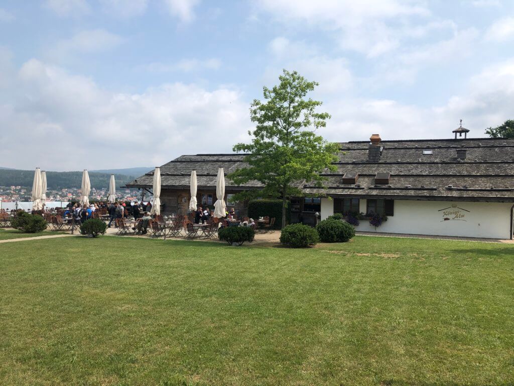
Behind a playground, you’ll find a bridge over river Nieste and the toughest part of the section starts: a steady climb up to a noble fir where you can relax on a bench. Make a turn left, leave the forest and you’ll have good views on the villages Dahlheim and Nieste. The Kassel-Steig then leads along the forest and then you’ll find a waypoint where you can turn left towards the former castle Sensenstein. There is not much to see but you can continue some hundred meters towards the Königsalm, a nice restaurant serving Bavarian food with good views on Nieste. It is a detour of 1.7 kilometres each way that I highly recommend.
Back on the Kassel-Steig the path leads you through the fields to the Gut Windhausen – a manor house with a former English landscape garden with Germanic elements. First, you‘ll walk down to the mausoleum of Martin Ernst von Schlieffen and then the path brings you to all staffages that are remaining: the broken-down devil‘s bridge, the monkey house, the friendship stone, the monkey memorial (von Schlieffen held some monkeys here) and via the old lake to the manor house. North of it you‘ll find three pseudo-Germanic Memorials dedicated to Tuisto, Arminius and Nerthus (here called Hertha). When leaving the park you‘ll have to cross a street to reach a parking area. From there you have good views on Kassel and continue along the forest.
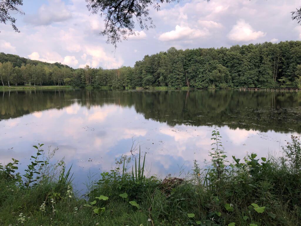
The Kassel-Steig then turns left and crosses the road again. From here you can turn right to Heiligenrode if you want to split the section into two parts. Otherwise, continue down the hill towards Niederkaufungen where you will find river Losse. Walk along the river which floats beautifully through the city until you reach Oberkaufungen. At Oberkaufungen you can‘t miss the Steinertsee, an artificial lake created in an area where once brown coal was taken from the earth. There are also a playground and a frog lake. Behind the lake, you can find the Steinertseebahn – a mini railway that children can ride. If you want to go there check their opening times online. The railway operates mostly on public holidays. Walk towards the city and after crossing the tracks of a normal railway you get into a residential zone. After some meters turn right to find the tramway stop Oberkaufungen-Mitte. Tramway 4 brings you back from here to the city.
7: Oberkaufungen to Wellerode
This part of the Kassel-Steig is easy, gives you good views on Kassel but doesn’t include touristic highlights. It starts at the tramway stop ‘Oberkaufungen Mitte’ which you reach with tramway 4. From the stop, you’ll have to walk to the Stiftskirche, an ancient church next to a manor. From there you have to walk towards the forest, take a hollow way up the hill and pass under the federal street 7. When you arrived on the hill you can look down on Oberkaufungen and after walking a long way through the fields you’ll see Kassel in front of you.
After turning towards the forest you need to watch out for a small path that leads into the forest on the right-hand side and down the hill. Storms have tipped a lot of trees over in this region and therefore it is a little bit harder to stay on the path. When you’ve reached the small river Setze-Bach turn right and walk towards the former beer garden Setzebach that is unfortunately closed. From there you’ll have to switch over to the next and bigger forest and you can then walk on a forest road for 2.5 kilometres. There is only one bench for a rest but you can enjoy the high trees in that area.
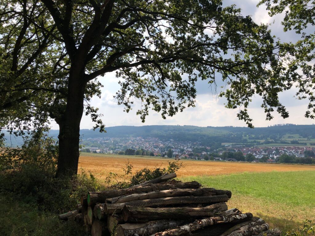
When leaving the forest you will have nice views on the village Vollmarshausen and when you reach the car park Heupel you can either decide to return to Kassel via Vollmarshausen or to continue your way along the forest until you reach Wellerode. The Kassel-Steig stays for a while high above Wellerode where you’ll find some benches. It then turns right and leads you straight down the hill to the village and to the protestant church. Next to it, you will find the bus stop ‘Kirche‘ (church) where bus 37 picks you up and brings you back to Kassel.
8: Wellerode to Dörnhagen
Section 8 of the Kassel-Steig leads you around the Söhre mountain clearly visible from Kassel because of the high windmills (with red flashing lights) standing on it. It is an easy walk of 14.3 kilometres length. Take bus 37 from Kulturbahnhof or Platz der Deutschen Einheit to the bus stop ‘Kirche‘ at Wellerode, Söhrewald. From there you need to walk back in the direction from which you were coming from. After passing the restaurant ‘Zur Söhrebahn‘ (decorated with railway items) you need to take the Goethestraße which brings you up to the former railway track. You can then walk for half a kilometre on the converted tracks of the former Söhrebahn and you will also see an ancient stone placed there to request forgiveness for a deed.
The Kassel-Steig brings you up the hill through some fields and leads you into a wonderful forest. Don’t get used to the wide forest road as you will switch soon to a narrow wonderful path. Next to it, you will find trees and artworks of the Ars natura project. Once you’ve left the forest you will have nice views on Lohfelden and Kassel. Take to opportunity to stop at the protective hut as it will be the only one today. While you enjoy good views a road takes you along the Söhre and to the most boring part of section 8: walking along motorway A7. It ends when you have found the hikers parking area from which a path about renewable energy leads you up to giant windmills on the mountain.
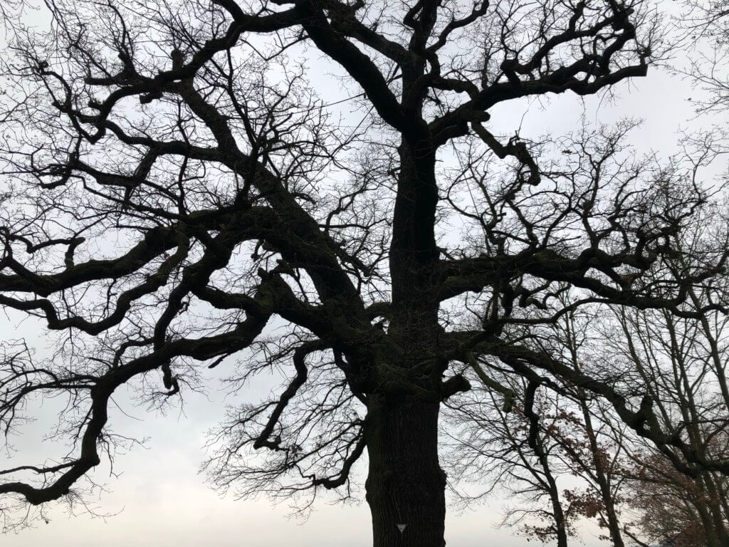
After that, you can steadily walk down the hill to Dörnhagen belonging to Fuldabrück. Once you’ve reached the houses of the village you need to walk along the fenced border: the Kassel-Steig leads you around the complete village to give you good views and show you an ancient oak and traditional orchards. This section ends at the bus-stop Dörnhagen-Siedlung from where bus 17 brings you back to the city centre. Around the bus stop, you can find restaurants and a bakery if you need to refresh and regenerate.
9: Dörnhagen to Großenritte
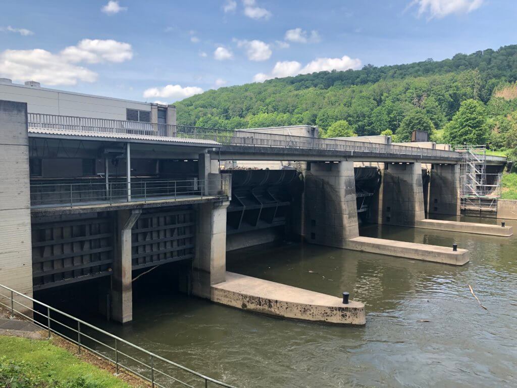
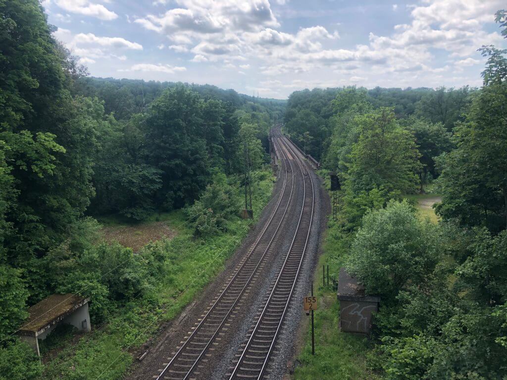
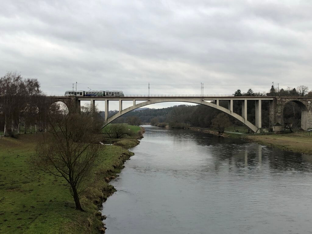
Section 9 is a long, beautiful and rather an easy one. It gives you the chance to cross river Fulda a second time (after section 4) and leads you then through the nice valley of river Bauna. It starts at the bus-stop Dörnhagen-Siedlung at Fuldabrück which you can easily reach with bus 17. When you exit the bus check the marks of the Kassel-Steig to ensure that you’re following section 9 and are not going section 8 backwards. You will pass the protestant church of the village and after leaving it you need to take a bridge over motorway A7. Behind it the path becomes nice, you can catch first glimpses of river Fulda and see the Märkerstein – an ancient stone from 1594 separating the area. After crossing a railway track the road turns to the right and leads you down to river Fulda. At the river, you can watch trains running via a large railway bridge that has been destroyed during World War II and rebuilt in modern fashion afterwards.
Behind the railway bridge, you need to take a bridge for pedestrians and cars which is special as in one pillar of the bridge accidentally a young woman is buried. Behind the bridge the Kassel-Steig turns right and follows the Fulda and the many sheep next to it until Alex’ Ruh is reached; a rest area named after a Syrian carpenter living in the village close-by. From there you’ll have to pass through Guntershausen (belonging to Baunatal) and you will then cross and follow the river Bauna which gives the valley and the city its name. The upcoming kilometres are then the most beautiful of this section: walking along the river and through nice forests. You will see the Riesenstein (a man-made giant stone) and you will find two protective huts. When you’ve reached the Höllewiesenhütte you need to walk up through the forest and will get close to Kirchbauna, the motorway A49 to Frankfurt am Main and one part of the giant Volkswagen factory at Baunatal. What you would not expect is that you are very close to the famous shopping mall Ratio-Land. If you would leave the forest where a sign guides you to a bus stop you would be in fact standing directly at their parking area.
When you’ve passed under motorway A49 you can see a little bit of Kirchbauna and have a rest at their village centre. Afterwards, you need to continue towards Baunatal and after passing the cemetery and a flood-protection zone the Kassel-Steig makes a detour to show you the ‘Via Dolorosa‘ of Baunatal. Now that you’ve followed river Bauna for a while the path then follows the smaller river Leisel to an artificial lake created from its waters. From there you will walk up the hill into the fields to get a good overview of Baunatal (and you can also see the giant lights of the soccer stadium). Then you will get to the city quarter Großenritte where you can visit the protestant church, see the centre and finally get to the railway station Großenritte-Bahnhof which is a special one. From here tramways of line 5 bring you every 15 minutes back to Kassel – but it is also the stop of Hessencourrier, an old railway with steam-engine trains sharing the tracks with the tramway in this area. If you want to see their steam-engine better book a trip with them, the Hessencourrier is operated by voluntary staff and doesn’t run very often.
10: Großenritte to Hoof
This section starts with some pain. When you arrived with tramway 5 at Großenritte-Bahnhof you will again see the high mountain next to the city (the Burgberg) – and that is your first destination. The Kassel-Steig will guide you through Großenritte and you will leave it near the Kulturhalle and sports area. Prior to climbing up you can take a very short detour to the right at the border of the forest and watch some deer. After that, the path leads steadily up the hill. When you’ve reached the highest point behind the Burgberg a narrow path leads you up the hill to the ancient fortifications.
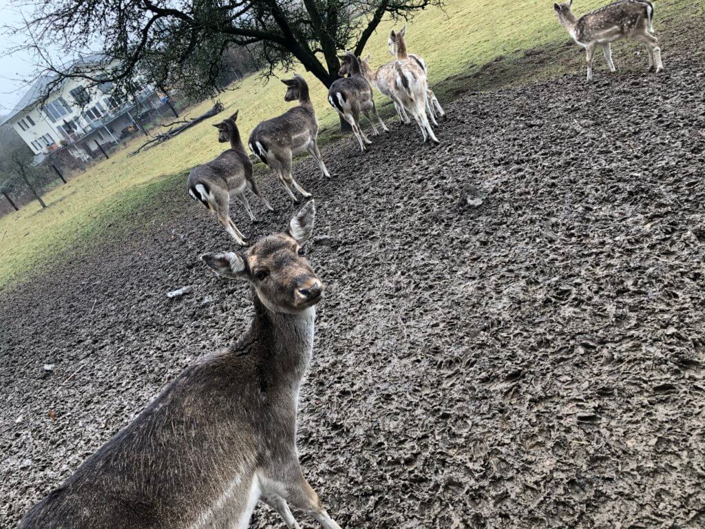
It is a lonesome place and wild deer lives there. On a sunny day, you will enjoy good views on Baunatal from there. Afterwards, the path leads you back to Großenritte on the other side of the mountain; it is like doing sports and walk up and down a mountain. When you leave the forest close to the Gertrudenstift (a retirement home) the section gets more pleasant and the path continues along the forest in the direction of Hoof, belonging to Schauenburg. You will pass the river Leisel again and find some nice rest areas with good views along your way.
Then the Kassel-Steig enters a nice forest and the signage gets very reduced as there is only one path through the forest. Suddenly the Kassel-Steig turns left and leads you up a mountain to give you good views on Baunatal (first) and Schauenburg (second). When the forest ends you’ll have to use an underpass to cross a larger road and then you are directly standing in front of the bus-stop Hoof-Bahnhof from where bus 52/53 brings you to the Kassel-Wilhelmshöhe railway station where you’ll have good connections to get home. Not far away from the bus stop, you can find the old railway station building where still today the Hessencourrier stops. If you need a safe harbour: close to the station you can find the restaurant ‘Himmel‘.
11: Hoof to Brasselsberg
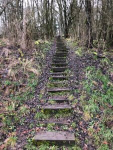
If you like inclination then section 11 is great: It first takes you up the Burgberg of Hoof, Schauenburg, and leads you then to my favourite hiking area: the Brasselsberg. After arriving with bus 52/53 at Hoof-Bahnhof you can already see the Burgberg. Climbing up is easier than expected as the path up is a mix of old wooden stairs and flat forest ways. On top of the mountain, you will find many remains of the former fortification and you will have amazing views. Afterwards, you need to leave the mountain on the reverse side, walk through Hoof and pass under motorway A44. Now the Kassel-Steig leads steadily up the hill but what you will find at the top is rewarding: wonderful meadows used to hold cattle – except in winter times when skiing is possible beginning from the mountain ‘Hohes Gras‘.
You can have a break hear at a protective hut or walk some meters on to the Herbsthäuschen; a nice restaurant in the forest. Next to it, you can also visit the opening of a former mine (the Schlösserstollen) and the Kassel-Steig then leads you down into the Firnsbachtal – a nice valley where river Firnsbach runs down. At the middle of the valley, the Kassel-Steig leaves it and turns up again. You will find a crossing shortly before the Teufelseck (devils corner) where you can walk to the Hirzstein and enjoy great views on Schauenburg and Baunatal (highly recommended!).
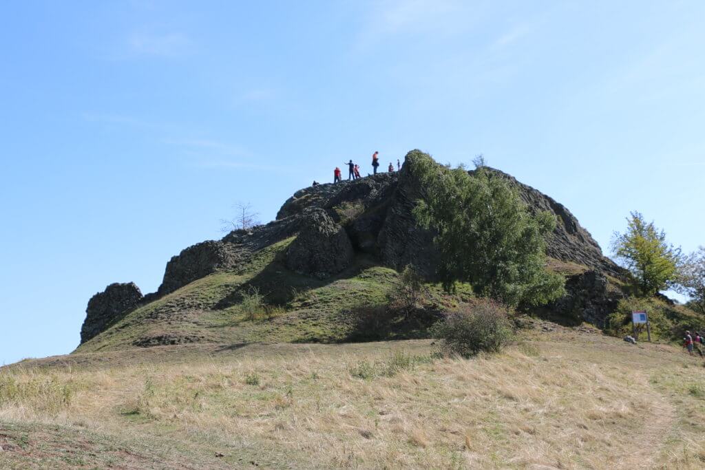
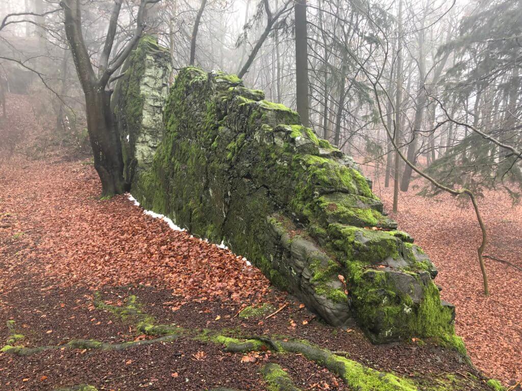
When you return and turn right, you might see a strange rock formation, the Teufelsmauer (devils wall). It consists of basalt from volcanic eruptions and looks like a giant wall. In fact, the basalt went into gaps within weaker material that dissolved over time. The Kassel-Steig continues in the direction of the city quarter Brasselsberg and then you will pass the Porta Lapidaria, a natural gate out of two big stones. Behind that, there is some kind of roundabout in the forest and one of the many ways leads you to the Bilsteinklippen – volcanic rock formations.
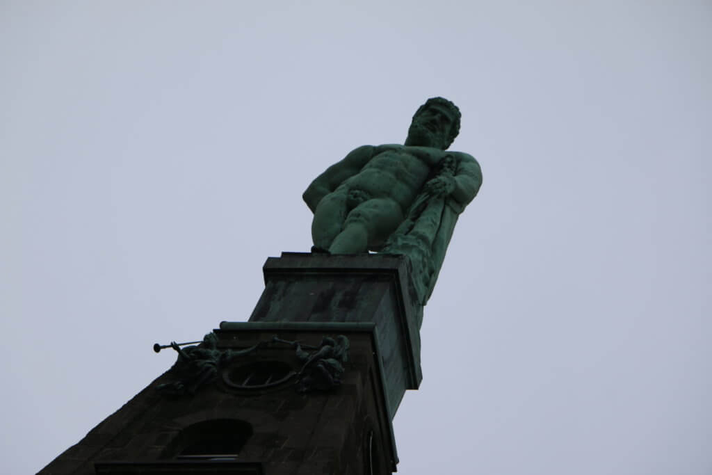
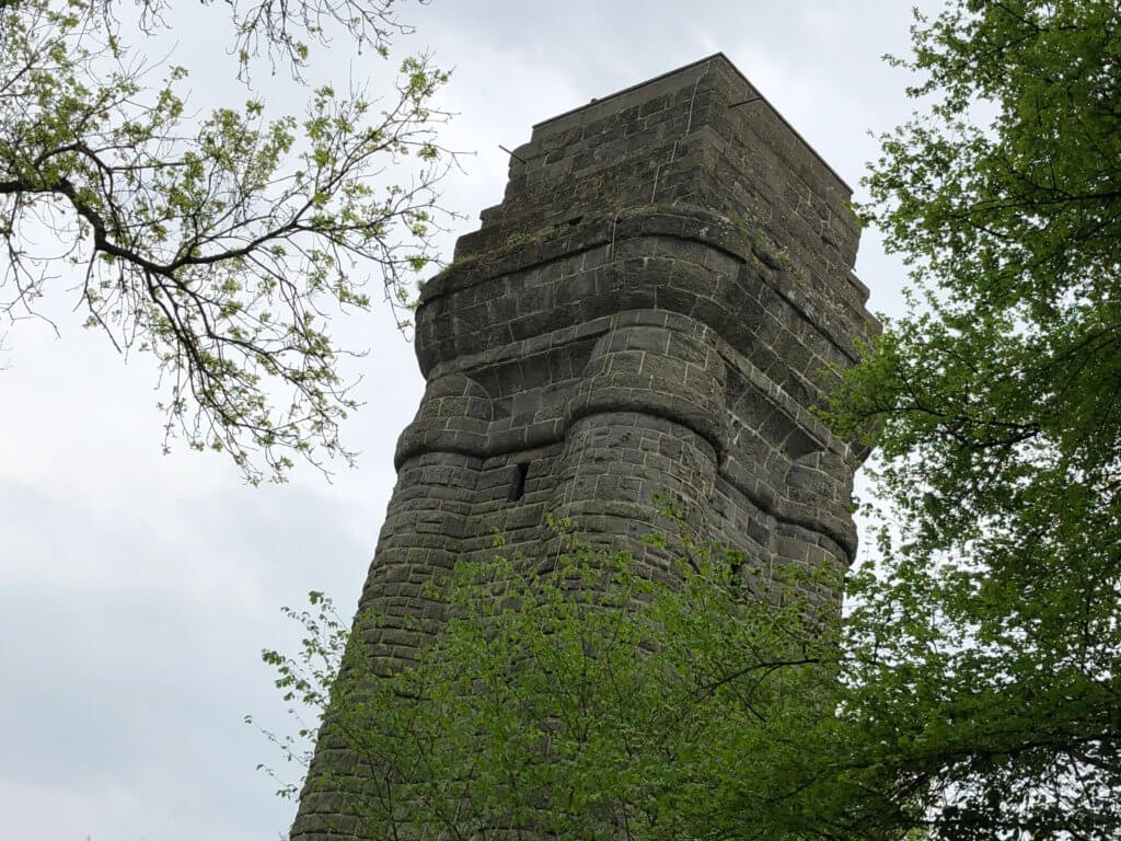
After returning to the roundabout the path directly opposite leads you to the Bismarckturm tower. It is always open and you only can’t climb up in case of a thunderstorm – the staircase works as the lightning rod. From there you can have nice views of the city. After walking back a short but narrow path takes you down to bus stop Blütenweg where different busses pass by – they take you to Druseltal for tramway 4 but also to the Kassel-Wilhelmshöhe railway station.
12: Brasselsberg to Herkules
The last section of the Kassel-Steig starts at the bus stop Blütenweg underneath the Bismarckturm tower. It is easy to reach if you take tramway 4 to Druseltal and switch there to bus 52 – it’s only three stops. The path then crosses the Dönche, the only city quarter of Kassel without inhabitants: it is a nature reserve. In the northern part, you will find an area full of old oaks, the Hutewiesen. From there you’ll pass the tramway stop Druseltal and behind a retirement home, you’ll have to climb up a hill.
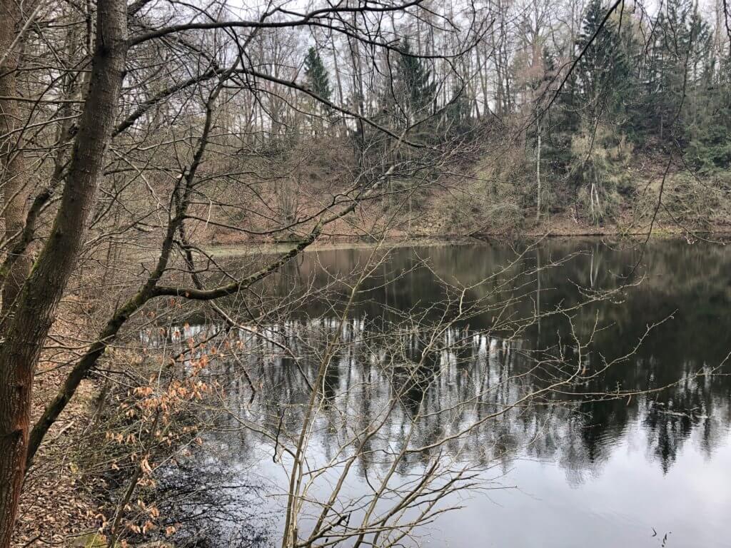
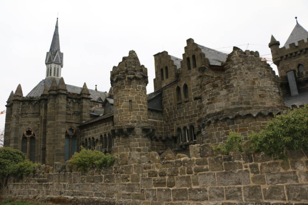
On top of the hill called Hunrodsberg, you will find an artificial lake that feeds the water games in the Bergpark Wilhelmshöhe, the Asch. It receives water from former mines and it is transported there via a long channel. Once in a while, you should check out this path beginning at Neu-Holland. The Kassel-Steig now leads you down the hill to the romantic Löwenburg castle. It was built as a ruin and needs constant restoration works because of the weak material used.
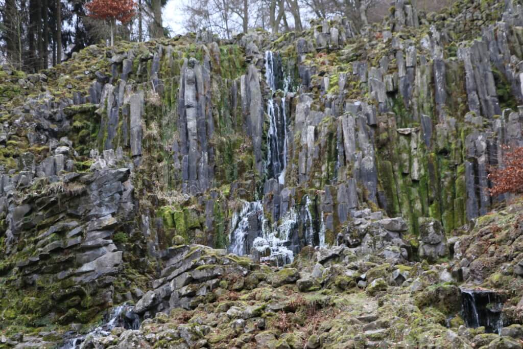
The next stop is the Steinhöfer Wasserfall which is also artificial and receives the water from lake Asch which you already know. Water is constantly dripping down the waterfall but it becomes really beautiful during the water games held on weekends (check the respective web sites). The rest of the Kassel-Steig is then just climbing up the hill along the cascades to the Herkules monument. 160 kilometres around Kassel are done and the surroundings of the city are now well known to you.
Additional information
The Kassel-Steig is clearly marked with blue signs and the white letters ‘KS‘ for Kassel or ‘Kassel-Steig‘. Arrows show you the direction you have to take and it’s relatively easy to follow the path. Nevertheless, it is good to have the official guide in your pocket that shows you a map for every section and gives detailed explanations about what can be seen:
Dieter Hankel / Lothar Glebe
Kassel-Steig
Ein Panoramawanderweg rund um das Kasseler Becken
12 Karten im Maßstab 1 : 50 000
Hessisch-Waldeckischer Gebirgsverein Kassel e.V.
Kartographische Kommunale Verlagsgesellschaft mbH
ISBN 978-3-86973-088-2
You can get the book in local bookshops but for sure also on the Internet. Just copy the ISBN book identifier to the website of your favourite supplier. Unfortunately, the book is only available in German – but the maps are worth to buy it. A good source is also the official website for the Kassel-Steig: http://kassel-steig.de. It is unfortunately only available in German – but there you can also download a document to track your progress and if you send it in you can get a Wanderabzeichen (a kind of trophy to reward you for your accomplishment).