
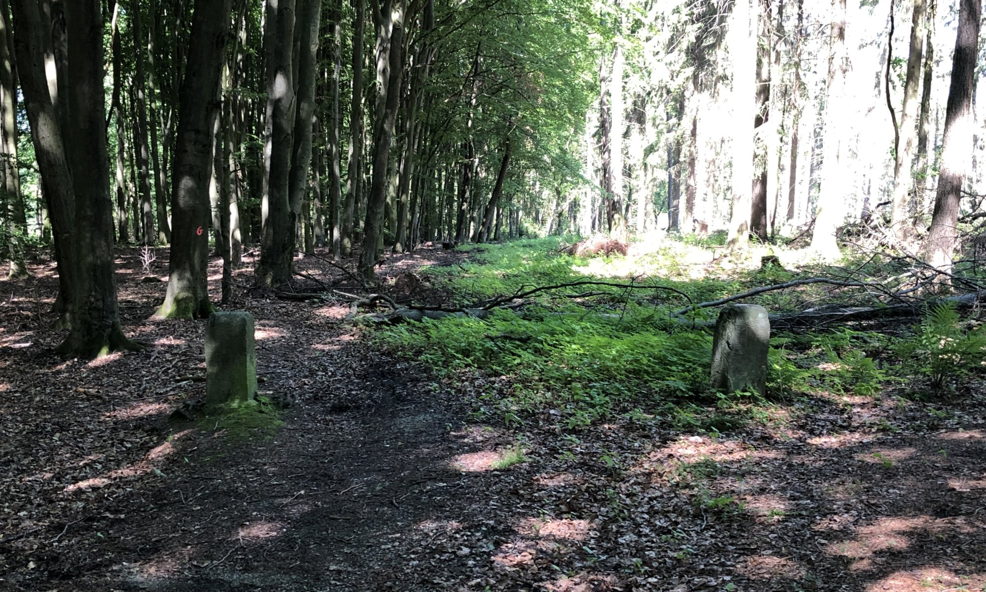
In the forest between Landwehrhagen, Staufenberg and Heiligenrode, Niestetal you can observe a special border situation: as both, the kingdom of Hannover and the landgraviate of Hesse-Kassel wanted to use a path through the forest they found an easy solution. The border stones are simply placed on the left and the right side of the path creating a ‘Niemandsland‘ (no man’s land) not belonging to one of these two parties. When you’re standing in between you’re neither in the kingdom nor in the landgraviate.
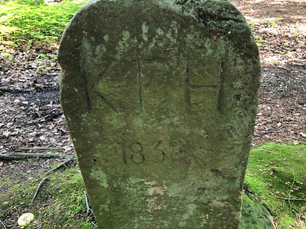
Kurfürstentum Hessen (1838), Niemandsland, Niestetal/Staufenberg 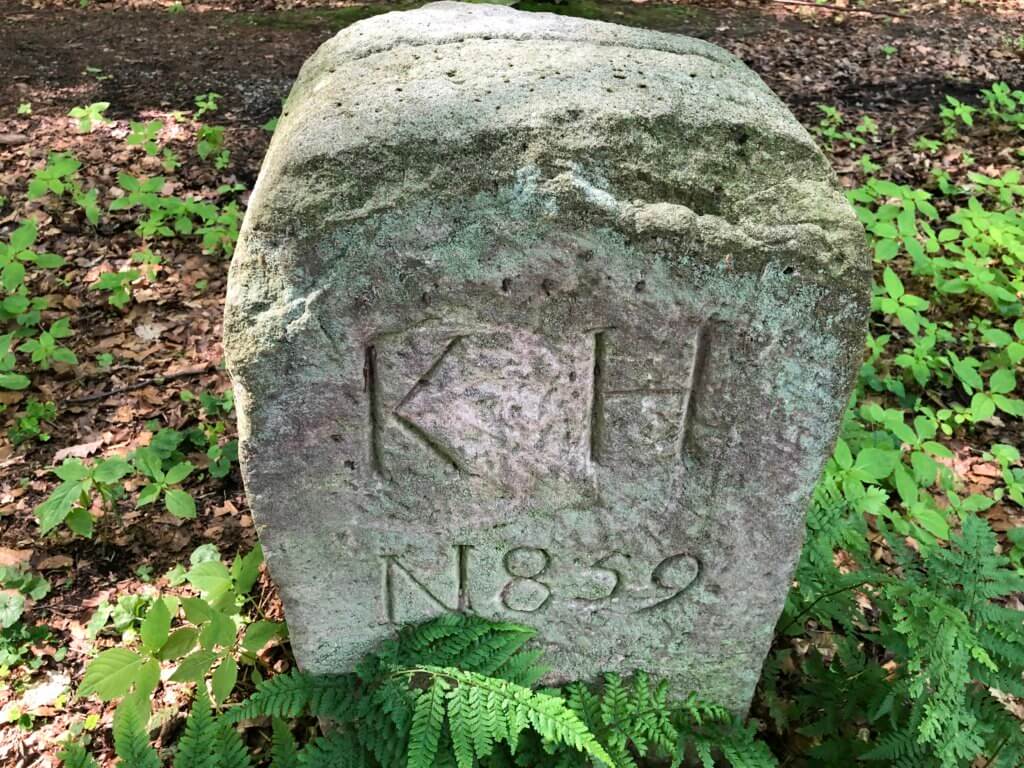
Königreich Hannover (1839), Niemandsland, Niestetal/Staufenberg
For todays German bureaucracy this is for sure an absolut inacceptable solution. And when looking on current maps it seems like that the path now belongs to Hesse and not to Lower Saxony (as the successors of the named former states). The ‘KH‘ stands for ‘Königreich Hannover‘, the ‘KFH‘ for ‘Kurfürstentum Hessen‘ – today often abbreviated as ‘Kurhessen‘.
Niemandsland
Niestetal/Staufenberg
Germany
Loading map...
