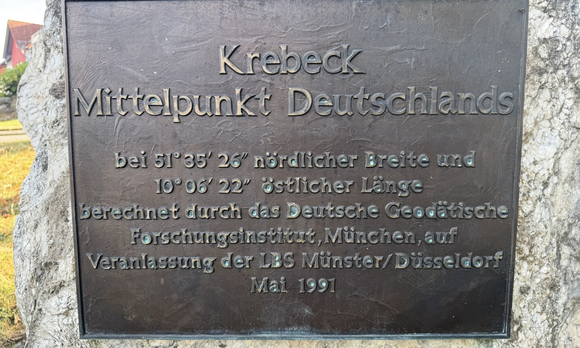
Krebeck, in the Samtgemeinde Gieboldehausen in the Göttingen district of Niedersachsen, is marked as the geodetic centre of Germany. In the village, a prominent stone with an information plaque commemorates the site, although the calculated point itself lies in the Struth woodland, roughly one kilometre north-west of the village centre, at 51°35′26″N, 10°06′22″E. The memorial was installed after German reunification and was inaugurated in 1991, with Bundestagspräsidentin Rita Süssmuth reported to have attended.
Krebeck was not officially proclaimed Germany’s centre by the federal government, since there is no legally recognised or official national midpoint. Rather, the claim arose from a calculation commissioned by the Landesbausparkasse Münster in August 1990 and carried out by the Deutsches Geodätisches Forschungsinstitut in München. The institute used a three-dimensional model of Germany, representing the country’s boundary as polygonal lines and taking account not only of latitude and longitude but also of geographical relief – mountains, valleys and other variations in elevation. The model also included Germany’s islands, which is an important qualification.
There is no single indisputable centre because ‚the centre of Germany’ depends on the definition and calculation method. One approach draws a north-south line between the country’s extreme points and an east-west line between the westernmost and easternmost points; their intersection is usually placed at Niederdorla in Thüringen. Another calculates the geometric centre or centre of gravity of the national area, rather like balancing a cut-out map on a pin. The result changes according to whether islands and maritime territories are included, whether the Earth’s curvature is considered, and whether the country is treated as a flat area or as a three-dimensional relief model.
Several other places therefore present convincing alternative claims: Flinsberg, near Heilbad Heiligenstadt, is associated with a two-dimensional calculation based on minimising the distances to numerous boundary points; Niederdorla represents the traditional extreme-points method; and Mihla, now part of Amt Creuzburg in Thüringen, emerged from a modern ‚squaring‘ method that divided Germany into many small equal squares and identified the most central one. Other calculated or physically balanced centres have also been associated with Silberhausen, Landstreit and the area between Langula and Kammerforst. Krebeck is consequently best understood as Germany’s three-dimensional, island-inclusive geodetic centre – not as the sole answer to a question that has several mathematically legitimate answers.
Mittelpunkt Deutschlands
Krebeck
Samtgemeinde Gieboldehausen
Germany
Loading map...
