
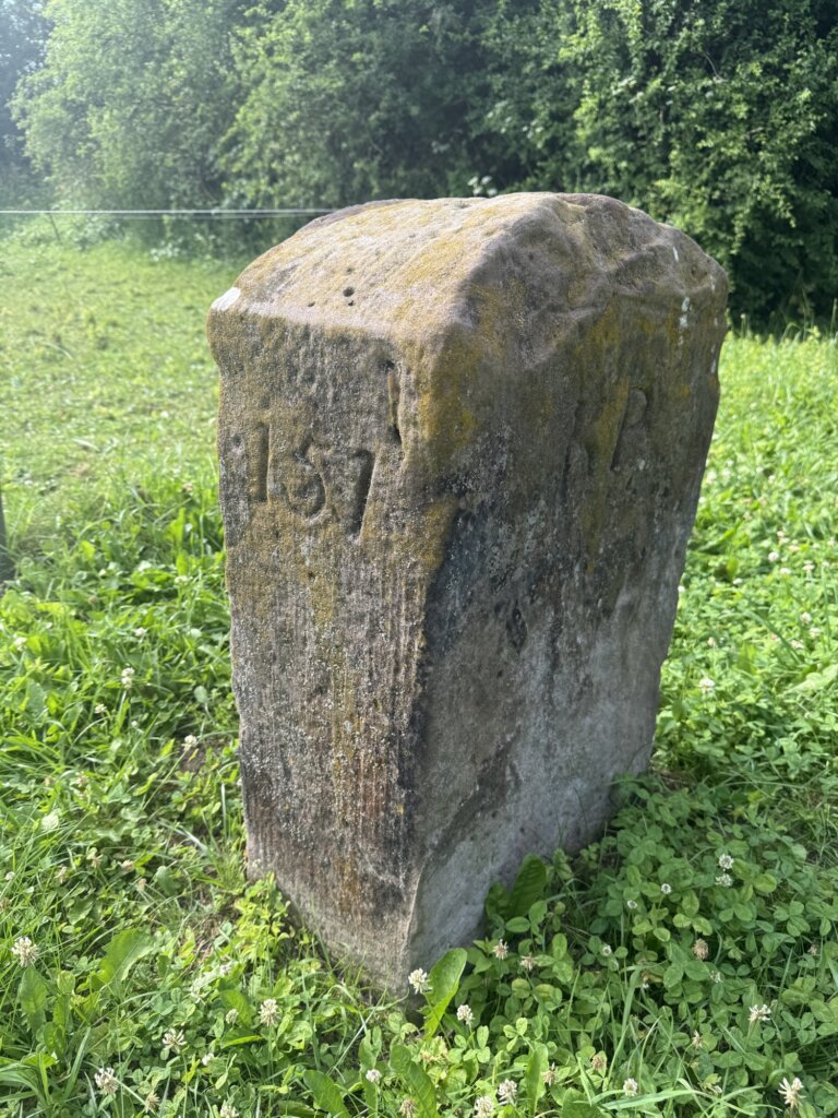
The Dreiländerstein near Friedland, Neu-Eichenberg and Hohengandern is a striking border marker because it has stood at a point where political frontiers repeatedly shifted over time. Before the modern German states existed, this spot marked the meeting point of older territorial claims; later it separated the Electorate of Hesse, the Kingdom of Hanover and the Kingdom of Prussia, which is still reflected in the stone’s historical inscriptions. After German reunification, it once again became a symbol of three neighbouring states meeting there: Hessen, Niedersachsen and Thüringen.
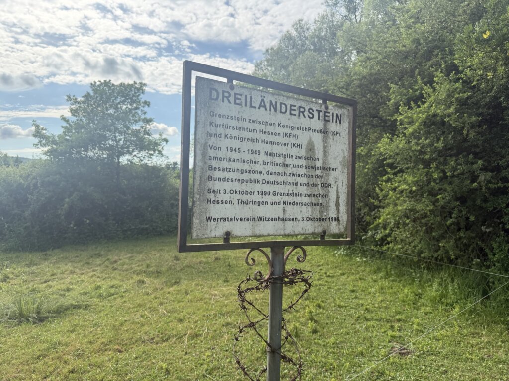
What makes the place especially unusual is its role after the Second World War. From 1945, it lay on the line between the American and British occupation zones in the west and the Soviet occupation zone in the east, and from 1949 it marked the division between the Federal Republic of Germany and the German Democratic Republic. There are not many other places where three occupation zones met in this way after 1945, which makes the Dreiländerstein historically exceptional. The other places are the location where Nordrhein-Westfalen, Hessen and Rheinland-Pfalz are bordering today (in the Westerwald between Siegen and Limburg) plus multiple locations at Berlin.
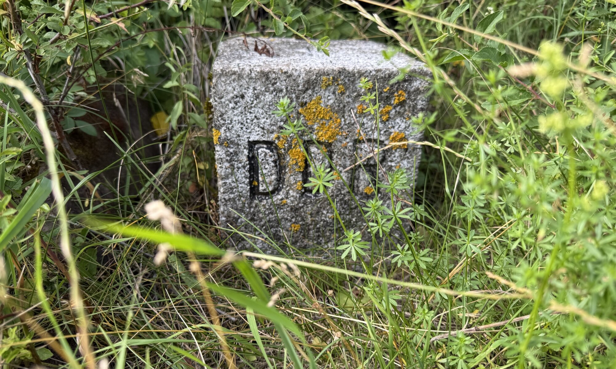
The marker for the border of the German Democratic Republic (DDR; used as header image for this post) can be found some meters up the hill next to the path leading to the old Dreiländerstein.
Dreiländerstein
Dreiländereck Niedersachsen-Hessen-Thüringen
Friedland / Neu-Eichenberg / Hohengandern
Germany
Loading map...
